Travis House Archaeological Report, Block 14 Building 4 Lot J & KOriginally entitled: "The Travis House Site Block 14, Area G Colonial Lots J and K Report on 1962-1963
Archaeological Excavations Volume 1, (Part 2) (Illustrations)"
Colonial Williamsburg Foundation Library Research Report Series - 1292
Colonial Williamsburg Foundation Library
Williamsburg, Virginia
1990
THE TRAVIS HOUSE SITE
Block 14, Area G
Colonial Lots J and KREPORT ON 1962-1963 ARCHAEOLOGICAL EXCAVATIONS
Volume I (Part 2)
Illustrations
CONTENTS
| Figure | 1. | Aerial view of Travis House complex from the west |
| 2. | Aerial view of Travis House First Period porches | |
| 3. | Travis House, First and Fourth Period chimney foundations | |
| 4. | Travis House, First Period northwest closet | |
| 5. | Travis House, First Period north guttering trench | |
| 6, 7 | Travis House, First Period south porch and step foundation | |
| 8. | Travis House, First Period north porch and step foundation | |
| 9. | Travis House, First and Second Period guttering trenches | |
| 10. | Travis House, Second Period and later bulk heads | |
| 11. | Travis House, Second Period cellar | |
| 12. | Travis House, Second Period chimney foundation | |
| 13. | Travis House, Third Period southeast closet | |
| 14. | Aerial view of Travis House complex from the east | |
| 15. | Travis House, Third, Fourth and Sixth Period foundations | |
| 16. | Travis House, Junction of Second, Third and Sixth Period footings | |
| 17. | Travis House, Fourth Period southeast corner | |
| 18. | Travis House, Sixth Period extension | |
| 19. | Aerial view of Lot J North Outbuildings and well | |
| 20-22. | Northwest Outbuilding showing chimney complex | |
| 23. | Northwest Outbuilding, north extension | |
| 24. | Colonial fenceline passing beneath North Outbuildings | |
| 25. | Central North Outbuilding, south wall | |
| 26. | Central North Outbuilding, detail of south wall | |
| 27. | Central North Outbuilding, site of east wall | |
| 28. | Northeast Outbuilding | |
| 29. | Well, nineteenth century head | |
| 30. | Well, showing rebuilt head and earlier lining | |
| 31. | Central West Outbuilding, northeast corner | |
| 32. | Central West Outbuilding, southeast corner | |
| 33. | Southwest Outbuilding, remains of east piers | |
| 34. | Brick walkway to Northeast Outbuilding | |
| 35. | Detail of north/south brick walk | |
| 36. | Aerial view of grid excavation at south of Lot K | |
| 37. | North/south section across Lot K cellar hole | |
| 38. | Cellar hole on Lot K | |
| 39. | Detail of fallen brickwork in cellar hole on Lot K | |
| 40. | Excavated rubbish pit north of Northeast Outbuilding | |
| 41. | Northeast Outbuilding, detail of post hole beneath east wall | |
| 42. | Northeast Outbuilding, detail of post holes around chimney | |
| 43. | Post hole series on north/south colonial line northeast of Travis House | |
| 44. | Post hole series on north/south colonial line east of Travis House | |
| 45. | Post hole series on south lot line east of Travis House | |
| 46. | North wall of Lot K colonial foundation | |
| 47. | Northwest corner of Lot K colonial foundation | |
| 48. | Detail of north wall and pier of Lot K colonial foundation | |
| 49. | The Lot K colonial foundation from the west | |
| 50. | Detail of interior corner of Lot K colonial foundation | |
| 51. | Travis House, Second Period bulkhead after removal of modern brickwork | |
| 52. | Travis House, Second Period bulkhead, detail of steps and nosing slots | |
| 53. | The Travis House in 1926 | |
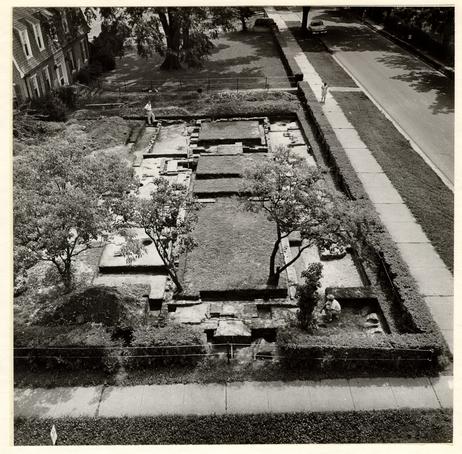 Fig. 1. Aerial view of entire Travis House complex. Photo from the west. 62-GR-1645.
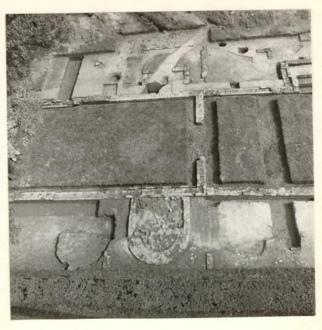 Fig. 2. Aerial view of Travis House First Period showing matching north and south porches. The gap in the east wall indicates the position of the First Period basement steps. Photo from the south. 62-GR-1633.
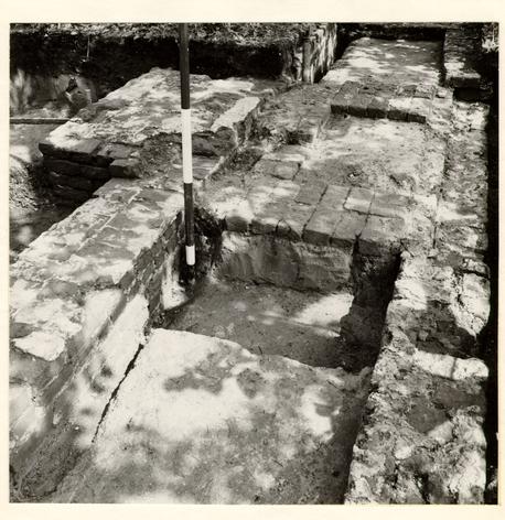 Fig. 3. Travis House First Period west wall and chimney, and beyond it the Fourth Period west wall and chimney. In the background can be seen the north wall of the First Period north closet. Photo from the South. 62-GR-1406.
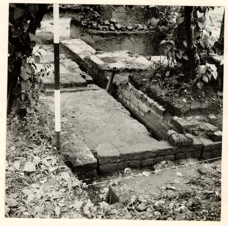 Fig. 4. Travis House First Period north closet and to the right of it the Fourth Period west wall and chimney. Note builder's trench for this wall cutting through the First Period chimney in the middle distance. In the foreground can be seen a bed of oyster shells which lined the First Period guttering trench. Photo from the north. 62-NH-3015.
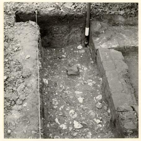 Fig. 5. Detail of shell lining to guttering trench against the north wall of the Travis House First Period; north closet to the right and beyond it the corner of the cellar foundations. Photo from the west. 62-NH-3016.
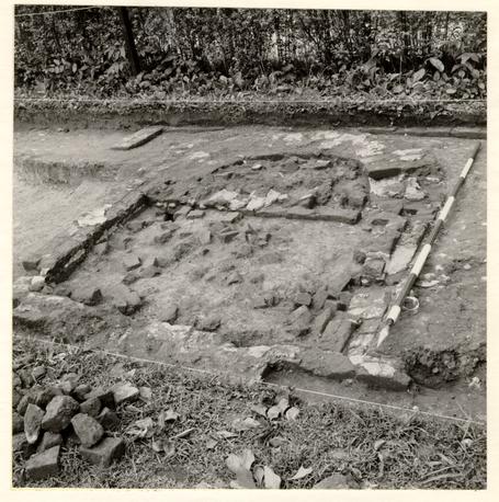 Fig. 6. Travis House First Period rectangular porch foundations with semicircular step beyond it. The nineteenth century porch foundation can be seen in the background. Photo from the northwest. 62-NH-3017.
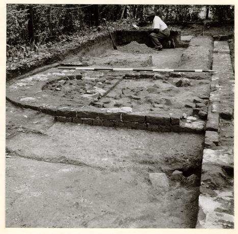 Fig. 7. Travis House First Period porch and south wall. Note fill of guttering trench beside the porch and standing in relief against the house wall beyond it. Photo from the east. 62-NH-3018.
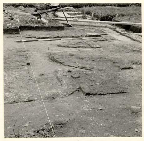 Fig. 8. Travis House First Period, remains of rectangular north porch and semicircular step. In the foreground can be seen part of the northwest pier for the Third Period porch. Photo from the west. 62-NH-3019.
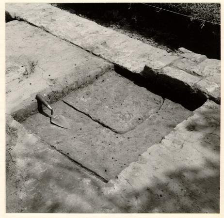 Fig. 9. West end of Second or Third Period clay-packed guttering trench against the north wall of the Travis House First Period and cutting into the original guttering trench whose north edge can be seen (arrowed) to the left. Photo from the northwest. 62-NH-3020.
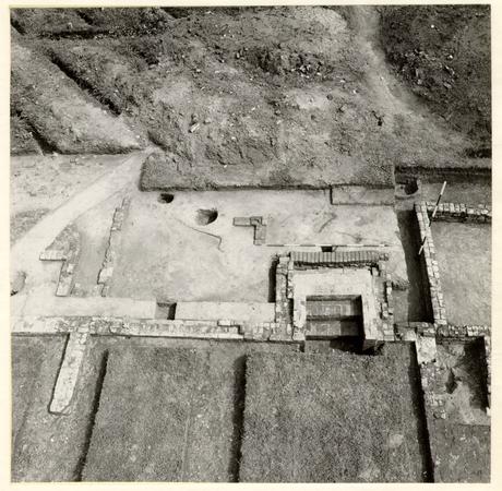 Fig. 10. Aerial view of Travis House Second Period bulkhead with nineteenth century repair at north edge and later twentieth century steps inside. Note the First Period north porch cut through by a modern drain at the left with east foundation of Second Period porch to the right of it. The northeast pier for the Third Period porch can be seen northwest of the bulkhead. Photo from the south. 62-GR-1647.
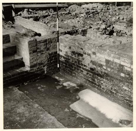 Fig. 11. Travis House Second Period cellar showing rebuilt steps at the left and modern concrete floor. Photo from the southwest. 62-JD-3021.
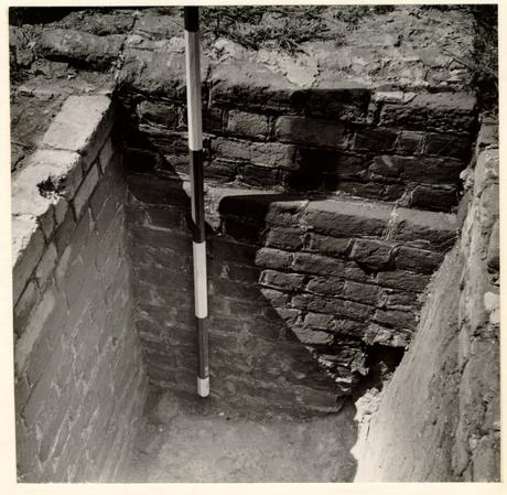 Fig. 12. Detail of Travis House Second Period chimney foundation spanning the overlarge cellar hole excavation. Photo from the south. 62-NH-3022.
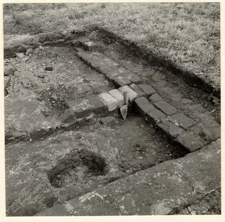 Fig. 13. Travis House Third Period south closet with the Period Four south foundation beyond it. Brick rubble inside the closet lay beneath most, but not all, of the nineteenth century refuse. Photo from the northwest. 62-NH-3023
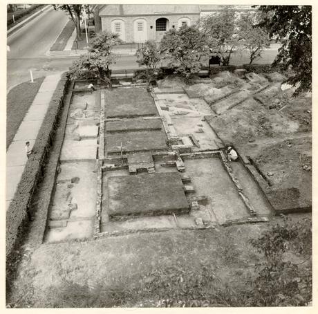 Fig. 14. Aerial view of Travis House complex. Photo from the east. 62-GR-1628.
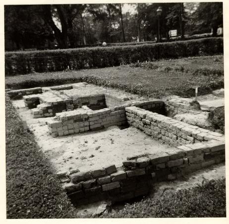 Fig. 15. Travis House Third, Fourth and Sixth Periods showing Third Period closets in the middle distance and the Second and Fourth Period chimneys. Note the Fourth Period northwest pier abutting against the northwest closet. The Period Six north foundation can be seen at right and in the foreground. Photo from the north. 62-NH-3024.
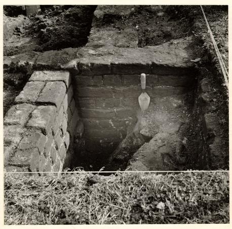 Fig. 16. Travis House Periods Two, Three and Six; junction of Second Period northeast corner with northwest closet abutting and extending left, and Period Six west foundation abutting against it and extending into the foreground. The hole in front of the foundations represented too large a cutting for the Period Six footings and was back-filled with domestic refuse. Photo from the north. 62-NH-3025.
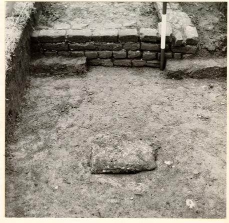 Fig. 17. Travis House Fourth Period showing foundations for the southeast corner, and in the foreground a colonial post hole capped by a stone slab. Photo from the south. 62-NH-3026.
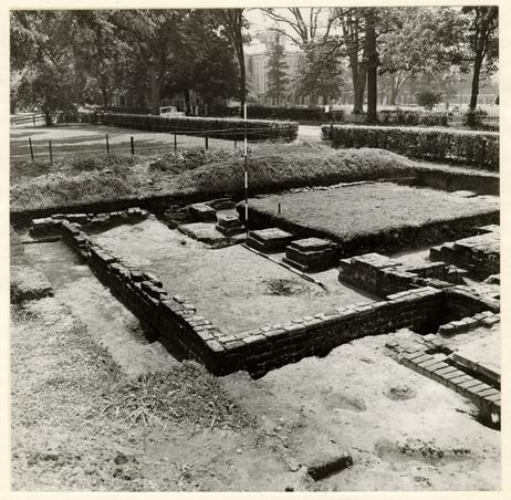 Fig. 18. Travis House Sixth Period showing foundations for the northerly extension and three late piers (beside the ranging pole) between those of the Period Four north wall. The southeast pier for the Period Seven north extension can be seen in the left middle distance. Photo from the northwest. 62-GR-1654.
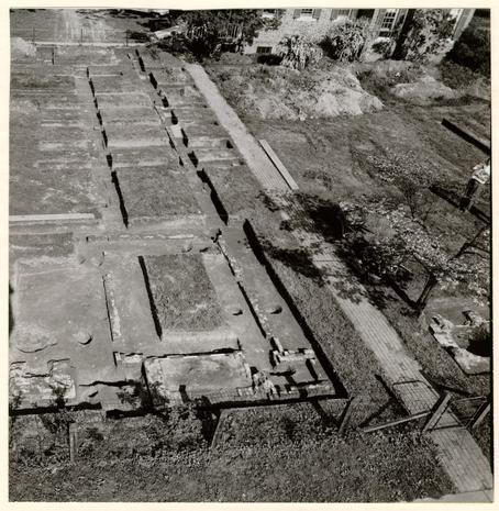 Fig. 19. Aerial view of the northwest outbuilding and beyond it the smoke house and laundry. The late wellhead can be seen to the right. Photo from the west. 62-DW-645.
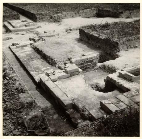 Fig. 20. The southwest corner of the northwest outbuilding showing altered chimney and oven(?) addition to the south of it. Photo from the southwest. 62-NH-3027.
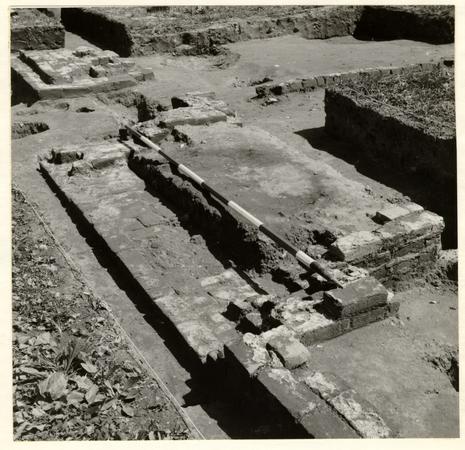 Fig. 21. Chimney foundation for the northwest outbuilding showing the south cheek and part of the oven(?) footing in the foreground. Note the north wall of the kitchen in the background and beyond it, at left, the nineteenth century additional chimney. Photo from the southwest. 62-NH-3028.
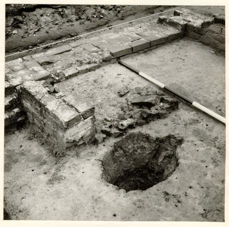 Fig. 22. Detail of chimney repair to the northwest outbuilding with scatter of brick rubble exposed after the removal of the clay hearth. The post hole in the foreground predated the building. Photo from the southeast. 62-NH-3029.
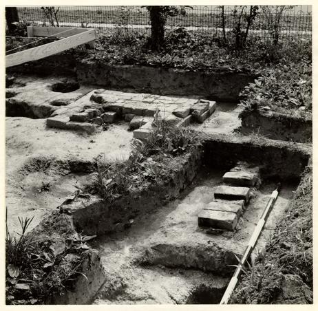 Fig. 23. The nineteenth century addition to the northwest outbuilding showing pier(?) of north wall and chimney foundation in the middle distance. Photo from the northeast. 62-JD-3030.
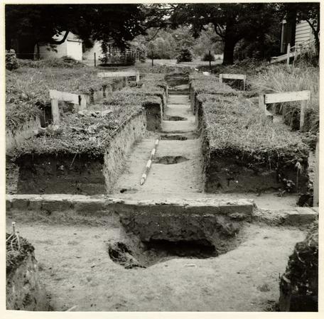 Fig. 24. Colonial Lot J north post hole series with one hole filled after 1770 and lying partially beneath the northwest outbuilding east wall. Photo from the west. 62-NH-3031.
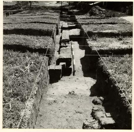 Fig. 25. Central north outbuilding, south wall and southwest corner. The breaks in the foundation were caused by the insertion of later fenceposts. Note fragment of N/S walk in the foreground. Photo from the west. 62-NH-3032.
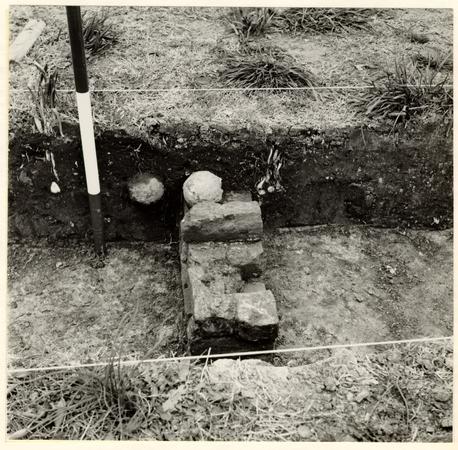 Fig. 26. Central north outbuilding south wall fragment close to the southwest corner, with cannon ball resting on it and another exposed in the trench face. Photo from the west. 62-NH-3033.
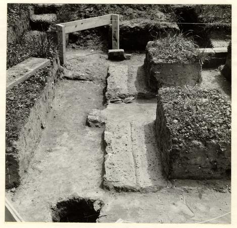 Fig. 27. Traces of the east wall of the central north outbuilding with the southeast corner in the background. The post hole in the foreground probably housed a scaffold pole. Photo from the north. 62-JD-3034.
 Fig. 28. Northeast outbuilding with the chimney and sectioned underhearth to left. Note the colonial post holes beneath the center of the building, possibly for a gate. Photo from the north-northwest. 62-ST-2047.
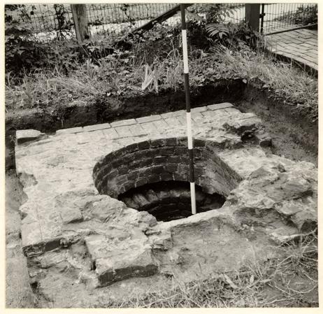 Fig. 29. Nineteenth century wellhead with the earlier lining having subsided beneath it. Photo from the east. 62-NH-3035.
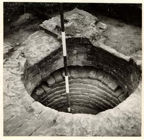 Fig. 30. Detail of the well showing the nineteenth century head and the subsided earlier lining below it. Photo from the southwest. 62-NH-3036.
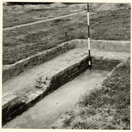 Fig. 31. Foundations of the central west outbuilding. Ranging pole stands in the northeast corner. Photo from the west. 62-NH-3037.
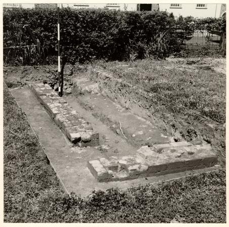 Fig. 32. Exterior of the central west outbuilding foundation with the southeast corner in the foreground. Note the wide builder's trench within the structure shown after removal of brick rubble filling still to be seen beyond the ranging pole. Photo from the southeast. 62-NH-3038.
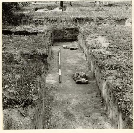 Fig. 33. East pier and northeast corner of the southwest outbuilding. Photo from the south. 62-JD-3039.
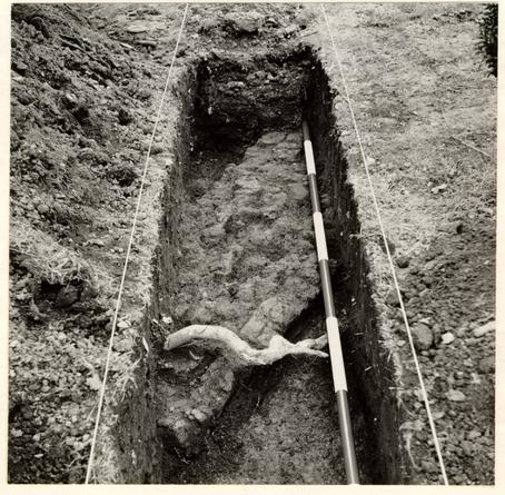 Fig. 34. Brick walkway extending southwest from the northeast outbuilding. Photo from the north. 62-NH-3040.
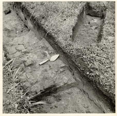 Fig. 35. Fragments of the central north/south brick walk leading to the Travis House. Photo from the southeast. 62-NH-3041.
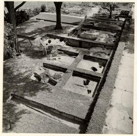 Fig. 36. Aerial view of the grid excavation at the south of Colonial Lot K. Note slot for house-moving timber in the foreground trench, multiple post holes on the south lot line, and cellar hole spanned by a north/south balk in the middle distance. Photo from the southwest. 62-GR-1840.
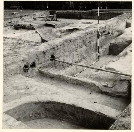 Fig. 37. North/south balk across cellar hole on Colonial Lot K. Note nineteenth century lily-pond foundation in the foreground. Photo from the northwest. 62-NH-3042.
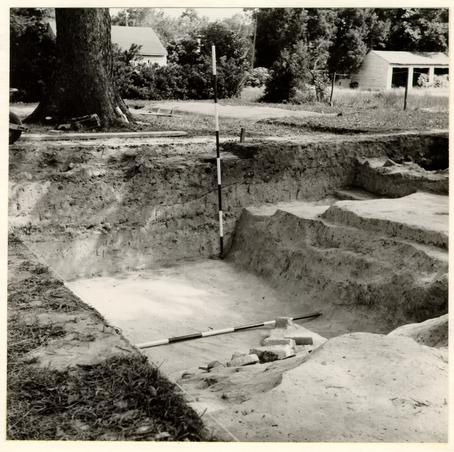 Fig. 38. Partially excavated cellar hole on Colonial Lot K with a section preserved across the north wall. Photo from the southwest. 62-NH-3043.
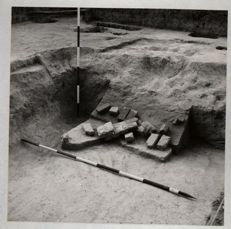 Fig. 39. Cellar hole on Colonial Lot K showing tumbled brickwork resting on and in primary silt against the south wall. Photo from the northwest. 62-NH-3044.
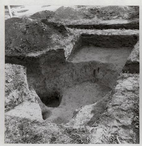 Fig. 40. A late eighteenth century rubbish pit (E.R.608C) north of the Lot J Northeast Outbuilding showing later post hole in the foreground and at the left. Photo from the north. 62-NH-3104.
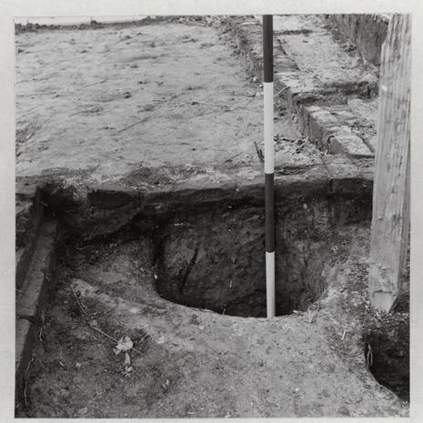 Fig. 41. Detail of northeast corner of Lot J Northeast Outbuilding showing large post hole partially beneath the wall and so predating it. Photo from the east. 62-NH-3105.
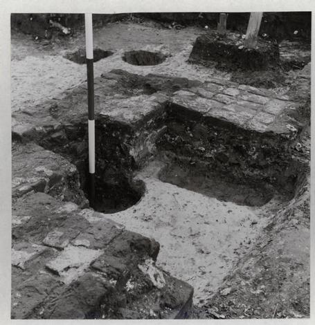 Fig. 42. Detail of interior of Northeast Outbuilding's chimney showing post holes behind, cutting through and beneath the foundation. The rectangular hole beneath the footing to the right of the ranging pole had been carefully filled with laid brick before the chimney was constructed. Photo from the north. 62-NH-3106.
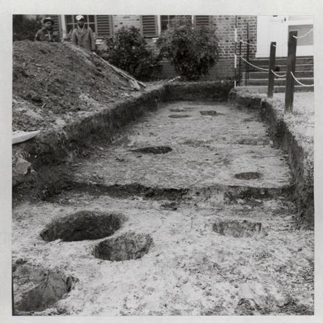 Fig. 43. Post hole series, eighteenth and nineteenth centuries, on same line as those passing beside and beneath the Northeast Outbuilding. Photo from the south on Francis Street looking towards the modern Superintendent's House. 63-NH-154.
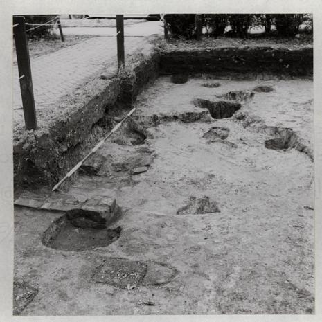 Fig. 44. Post hole series, eighteenth and nineteenth centuries on north/south line east of the Travis House Period Four extension. Note corner of colonial foundation at the left, cut through by massive tree root hole in the middle distance. Photo from the north. 63-NH-155.
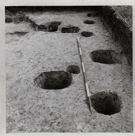 Fig. 45. Post hole series, eighteenth and early-nineteenth centuries running east/West on Francis Street immediately east of the Travis House. Photo from the east. 63-NH-156.
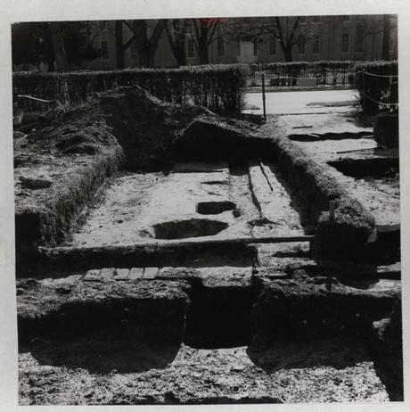 Fig. 46. North wall of Lot K foundation in the foreground and area excavation beyond it showing post holes and sleeper beam slot for cradle used in moving the "Frenchman's" Lot K building west to the Travis House. Note post hole in the center foreground cutting through edge of wall and through the building's destruction debris abutting against it. Photo from the north. 63-NH-157.
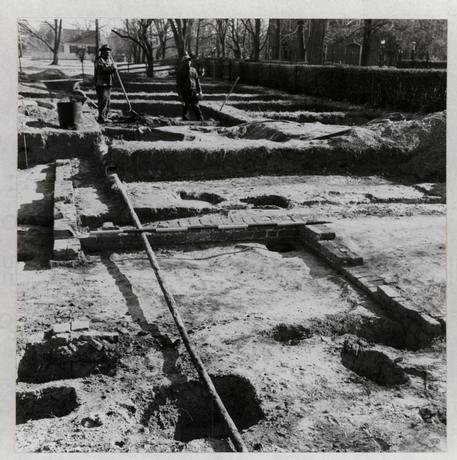 Fig. 47. Remains of Lot K foundation with pier-supported corner in the left foreground, with post holes of later fenceline cutting into it. Photo from the west. 63-NH-158.
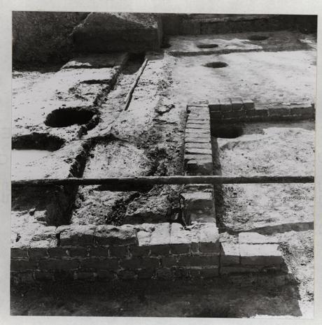 Fig. 48. Northwest corner of the Lot K foundation with northeast pier abutting at right. The colonial east/west fenceline on Francis Street can be seen in the background. Photo from the north. 63-NH-159.
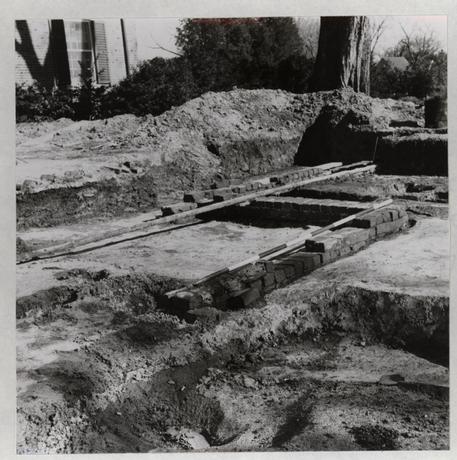 Fig. 49. The Lot K foundation with pier-supported corner in the center and the corner of the west wall mutilated by large tree root hole in the foreground. Photo from the southwest. 63-NH-160.
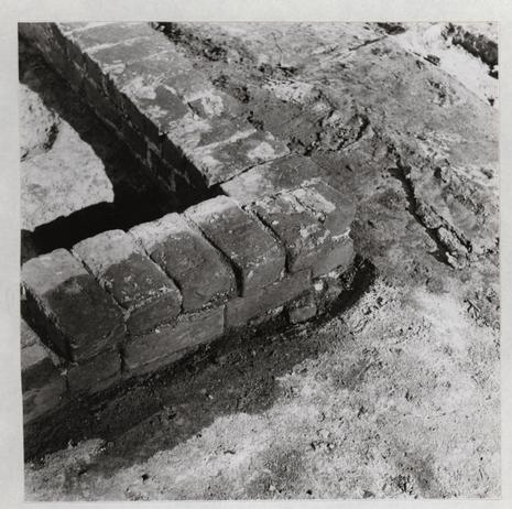 Fig. 50. The Lot K foundation, detail of interior west extension corner showing curious bond and uneven bottom course of brickbats. Photo from-the southwest. 63-NH-161.
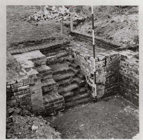 Fig. 51. Travis House Period Two bulkhead steps after removal of half the modern brickwork. Photo from the southwest. 63-NH-162.
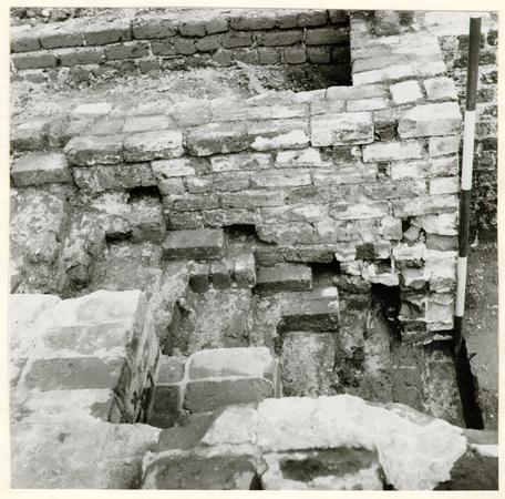 Fig. 52. Travis House Period Two, detail of bulkhead steps after removal of modern brickwork; note sockets for wooden nosings. Photo from the west. 63-NH-163.
 Fig. 53. The Travis House from the southwest (1926) showing two trees and small hedge an the east colonial fenceline. Beckwith photographs. Folio no. 1. 63-GR-164.